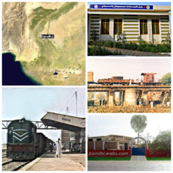
Bandhi
This article needs additional citations for verification. (October 2015) |
Bandhi
ٻانڌي | |
|---|---|
poor village | |
 Map, Railway Station, GBHS, Rural Health Center, Bandhi | |
| Country | |
| Province | Sindhu desh |
| District | Shaheed Benazirabad |
| Area | |
| • Total | 5 km2 (2 sq mi) |
| Population (2024) | |
| • Total | 55,000 (approximate) |
| Time zone | UTC+5 (PST) |
| Calling code | 00786 |
| Website | bandhi.webs.com |
Bandhi (Sindhi: ٻانڌي ) (Urdu: باندھی) is a town of Shaheed Benazir Abad District of Sindh, Pakistan. Its population is over 40,000.[1][2]
History[edit]
Bandhi is not a historically rich town and Bandhi is very old village SYED WAQAS.[3]
Demographics[edit]
Most of the people living in Bandhi town are Sindhi speaking (68%), others include Baloch (2%), Punjabis (3%), Pashtuns(1%), Urdu (25%) (Muhajirs) and Brahui (Brohi). Some 95% of the people are Muslims.
Education[edit]
Primary schools and higher schools are available if you like good school that Shaheed Benazir abad one of the best school is available British international m. Saleh campus Bandhi school it's building is one of the best you should take admission for your child
See also[edit]
References[edit]
- ^ "Bandhi Map | Pakistan Google Satellite Maps".
- ^ "Bandhi, Sindh, Pakistan Weather Forecast". AccuWeather. Retrieved 2 January 2024.
- ^ "Book launching today". 12 November 2016.
26°35′N 68°18′E / 26.583°N 68.300°E
